LaBoiteaux Woods
Ravine to Freedom on the Underground Railroad
LaBoiteaux Woods, a nature preserve in the Cincinnati neighborhood of College Hill, is believed to have been part of the Underground Railroad during the 1840s and 1850s. The LaBoiteauxs were early settlers in the College Hill/Mt. Healthy area, and several family members were known for their abolitionist views. The land was donated to the Cincinnati Parks Department by the family in the 1940s.
In 1892, longtime College Hill resident Harriet Wilson wrote letters to Wilbur H. Siebert, a professor of history at Ohio State University, detailing her community's, and her family's, involvement in the Underground Railroad. She wrote that freedom seekers "seemed gifted with a kind of magnetic power, which, with their grips and pass words, drew those of different localities together, making them choose the least travelled ways."
Deep ravines are located on either side of Hamilton Ave., which provided cover to enslaved people escaping the South through the Cincinnati area. Wilson was describing the landscape leading north to College Hill when she wrote that "the deep shadowed ravines and valleys lying on each side of our beautiful hill, soon seemed to be the popular route chosen by the wayfarers."
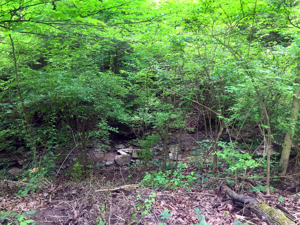
The Underground Railroad Freedom Center has called the eastern ravine, located in LaBoiteaux Woods and shown here, the “only documented and undeveloped Underground Railroad slave route” in our area.
The residents of numerous homes along Hamilton Ave. were known to provide food, shelter and transportation to enslaved people. On the eastern side, overlooking this ravine, lived the Strong and Skillman families. Zebulon Strong's first home, at 5434 Hamilton Ave., was used as a safe house. His second home on the street, at 5350 Hamilton Ave., contains several hiding places and is now the Six Acres Bed & Breakfast. Both families were involved with concealing and moving freedom seekers to the next Underground Railroad station.
LaBoiteaux Woods is a mixed deciduous forest. It's currently quite overgrown with invasive honeysuckle that was not part of the 19th century landscape of this area. During different times of the year, mulberries, wild ginger, spicebush, and nuts can be found, which were foraged by enslaved people crossing through the woods.
The habitat is also home to white-tailed deer, red and gray foxes, raccoons, opossums, minks, sharp-shinned hawks, barred owls, and eastern box turtles. Rugged hiking trails offer opportunities for exploration, surrounded by mature trees and native wildflowers.
On the perimeter are the scant remains of an old railroad line. There is a culvert (arched tunnel) over part of the ravine in LaBoiteaux Woods that used to be a railroad bridge. The train tracks were likely a way finding device for traveling freedom seekers. A power line that crosses Hamilton Ave. near Hammond North Condominiums is believed to have been part of this railroad as well.
Every year in mid-February, Cincinnati Parks commemorates Black History Month with its Ravine to Freedom hike to share with visitors this natural site and some of the stories it contains. The hike takes place in the evening during cold weather to mimic the experience of emancipation, which often took place during the winter, when it was easier for many people to run away without immediate detection, and when the frozen Ohio River was easier to cross.
For information regarding the Ravine to Freedom hike, or to schedule a private hike for your group, please call LaBoiteaux Woods at 513-542-2909.
Images